Geolocate

Hatzic Lake topographic map

Click on the map to display elevation.

About this map
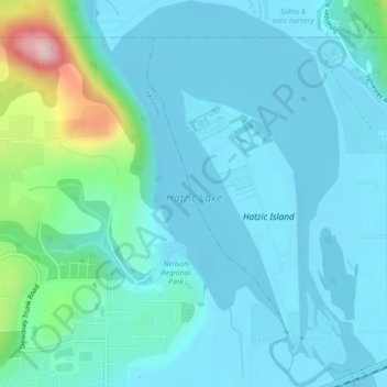
Name: Hatzic Lake topographic map, elevation, terrain.

Location: Hatzic Lake, Hatzic, Mission, British Columbia, Canada (49.15032 -122.25479 49.17943 -122.22403)

Average elevation: 43 m

Minimum elevation: -2 m

Maximum elevation: 288 m

British Columbia trails, hiking, mountain biking, running and outdoor activities

Gear up for your next adventure:

🥽Outdoor Goggles - Protective eyewear for outdoor activities
🥾Hiking Shorts - Breathable shorts suitable for summer hikes
🎒Fully Waterproof Backpack - Total protection for photography gear and electronics
🧥Waterproof Hiking Jacket - Protect yourself from rain and wind while hiking
🥾Hiking Shoes - Durable and comfortable shoes for trail hiking

As an Amazon Associate, this site earns from qualifying purchases at no extra cost to you.