
Thank you for supporting this site ❤️
Make a donation
Make a donation
Gear up for your next adventure:
As an Amazon Associate, this site earns from qualifying purchases at no extra cost to you.
Gümüş topographic map
Click on the map to display elevation.
Thank you for supporting this site ❤️
Make a donation
Make a donation
Gear up for your next adventure:
As an Amazon Associate, this site earns from qualifying purchases at no extra cost to you.
About this map
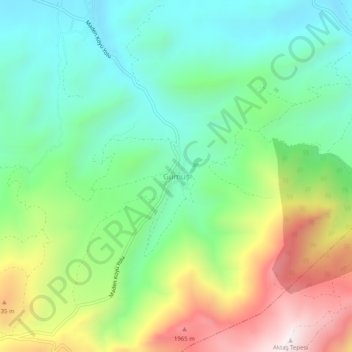
Name: Gümüş topographic map, elevation, terrain.
Location: Gümüş, Ulukışla, Niğde, Central Anatolia Region, Turkey (37.46661 34.59442 37.50661 34.63442)
Average elevation: 1,559 m
Minimum elevation: 1,261 m
Maximum elevation: 2,118 m
Thank you for supporting this site ❤️
Make a donation
Make a donation
Gear up for your next adventure:
As an Amazon Associate, this site earns from qualifying purchases at no extra cost to you.