Geolocate

Monte Pagliarone topographic map

Click on the map to display elevation.

About this map

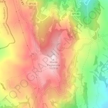
Name: Monte Pagliarone topographic map, elevation, terrain.

Location: Monte Pagliarone, Alberona, Foggia, Puglia, Italia (41.41803 15.11649 41.41813 15.11659)

Average elevation: 847 m

Minimum elevation: 594 m

Maximum elevation: 1,031 m

Gear up for your next adventure:

🛁Quick-Dry Microfiber Towel - Space-saving towel that dries rapidly on the move
🥾Trail Running Boots - Durable shoes designed for trail running
🥤Collapsible Travel Cup - Saves space and weight in your mess kit
🛶Waterproof Dry Bags - Keep electronics and clothes dry during river crossings
🔨Vehicle Emergency Tool - Safety tool for remote road trips to trailheads

As an Amazon Associate, this site earns from qualifying purchases at no extra cost to you.