Geolocate

Valmala topographic map

Click on the map to display elevation.

About this map

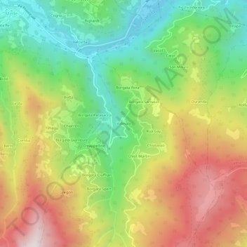
Name: Valmala topographic map, elevation, terrain.

Location: Valmala, Busca, Cuneo, Piedmont, Italy (44.52423 7.32603 44.56423 7.36603)

Average elevation: 995 m

Minimum elevation: 602 m

Maximum elevation: 1,483 m

Gear up for your next adventure:

🥤Collapsible Travel Cup - Saves space and weight in your mess kit
🔪Outdoor Multitool - Versatile tool for repairs and food prep in the wild
🧦Thermal Socks - Warm socks for winter hiking or camping
💧Hydration Pack - Hands-free hydration system for long hikes
🔦UV Flashlight - Detect minerals or specific insects in the dark

As an Amazon Associate, this site earns from qualifying purchases at no extra cost to you.