Geolocate

Woodbine topographic map

Click on the map to display elevation.

About this map

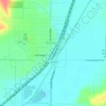
Name: Woodbine topographic map, elevation, terrain.

Location: Woodbine, Harrison County, Iowa, United States (41.72178 -95.73172 41.74737 -95.69598)

Average elevation: 328 m

Minimum elevation: 313 m

Maximum elevation: 388 m

Gear up for your next adventure:

🧥Insulated Jacket - Keep warm in cold outdoor conditions
🧦Outdoor Socks - Durable socks designed for hiking and outdoor sports
🥾Light Trekking Boots - Supportive boots for multi-day treks
🥾Mountain Hiking Shoes - Shoes with superior grip for mountainous terrain
🪜Heavy Duty Carabiners - Multi-use clips for securing gear to your backpack

As an Amazon Associate, this site earns from qualifying purchases at no extra cost to you.