Geolocate

Ojaiz topographic map

Click on the map to display elevation.

About this map

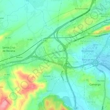
Name: Ojaiz topographic map, elevation, terrain.

Location: Ojaiz, Peñacastillo, Santander, Cantabria, 39011, España (43.42071 -3.90164 43.46071 -3.86164)

Average elevation: 38 m

Minimum elevation: -1 m

Maximum elevation: 129 m

Gear up for your next adventure:

🧢Outdoor Cap - Protective cap for sun and rain during hikes
🍽️Titanium Camping Spork - Ultralight and indestructible eating utensil
🦯Trekking Poles - Reduced impact on joints for steep topographic climbs
💧Collapsible Water Bottle - Space-saving water bottle for outdoor activities
💡LED Headlamp - Hands-free illumination for night hiking and camping

As an Amazon Associate, this site earns from qualifying purchases at no extra cost to you.