
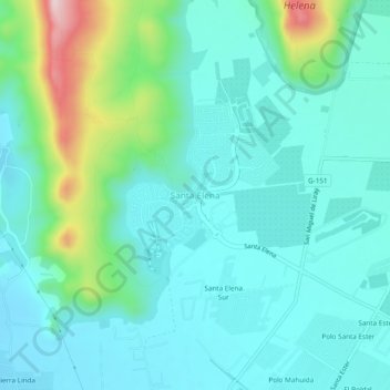
Santa Elena topographic map
Click on the map to display elevation.
About this map
Name: Santa Elena topographic map, elevation, terrain.
Average elevation: 579 m
Minimum elevation: 511 m
Maximum elevation: 847 m
Other topographic maps
Click on a map to view its topography, its elevation and its terrain.
Laguna Piedra Roja
Chile > Región Metropolitana de Santiago > Provincia de Chacabuco > Colina > Chicureo
Average elevation: 626 m
Canal El Carmen
Chile > Región Metropolitana de Santiago > Provincia de Chacabuco > Colina > Los Jardines de Colina
Average elevation: 533 m