Geolocate

Castagnola topographic map

Click on the map to display elevation.

About this map

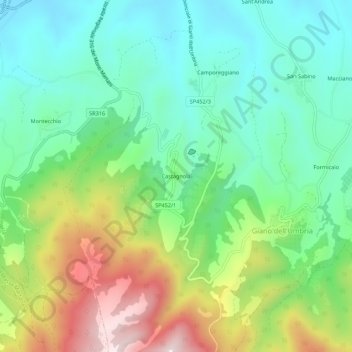
Name: Castagnola topographic map, elevation, terrain.

Location: Castagnola, Giano dell'Umbria, Perugia, Umbria, 06030, Italy (42.81967 12.54123 42.85967 12.58123)

Average elevation: 489 m

Minimum elevation: 304 m

Maximum elevation: 863 m

Gear up for your next adventure:

🔨Vehicle Emergency Tool - Safety tool for remote road trips to trailheads
🚲Handlebar Phone Mount - View topographic-map.com live while cycling
🧢Beanie Hat - Keep your head warm in cold weather
🧴First Aid Kit - Essential first aid supplies for outdoor emergencies
🥾Hiking Boots - Sturdy boots providing ankle support and traction on rugged trails

As an Amazon Associate, this site earns from qualifying purchases at no extra cost to you.