
Almont topographic map
Click on the map to display elevation.
About this map
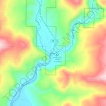
Name: Almont topographic map, elevation, terrain.
Location: Almont, Gunnison County, Colorado, 81210, United States (38.64471 -106.86615 38.68471 -106.82615)
Average elevation: 2,578 m
Minimum elevation: 2,431 m
Maximum elevation: 2,774 m
Other topographic maps
Click on a map to view its topography, its elevation and its terrain.
Crested Butte
United States > Colorado > Gunnison County
At the 2020 United States Census, the town had a total area of 535 acres (2.166 km2), all of it land. Crested Butte lies at an elevation of 8,885 feet (2,708 m) above sea level.
Average elevation: 2,798 m
Gunnison
United States > Colorado > Gunnison County
Also in 1880, the cattle industry in Gunnison was established. Realizing the poor conditions for farming (with only about eleven inches of rainfall annually and the short growing season due to the high elevation and alpine environment) the local farmers turned to ranching and began breeding cattle. To do this…
Average elevation: 2,369 m