Geolocate

Espenhain topographic map

Click on the map to display elevation.

About this map

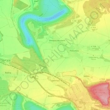
Name: Espenhain topographic map, elevation, terrain.

Location: Espenhain, Rötha, Landkreis Leipzig, Sachsen, Deutschland (51.17467 12.45105 51.24221 12.56276)

Average elevation: 140 m

Minimum elevation: 70 m

Maximum elevation: 229 m

Gear up for your next adventure:

🧢Hiking Hat - Sun-protective and breathable hats for long treks
🥾Mountain Trail Shoes - High-traction shoes for mountain trails
🧦Hiking Liner Socks - Thin base layer to prevent friction and blisters
🥾Trail Hiking Shoes - Durable shoes designed for rugged trails
🔪Outdoor Multitool - Versatile tool for repairs and food prep in the wild

As an Amazon Associate, this site earns from qualifying purchases at no extra cost to you.