
Vorderberg topographic map
Interactive map
Click on the map to display elevation.
About this map
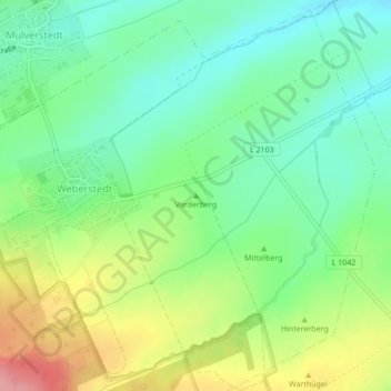
Name: Vorderberg topographic map, elevation, terrain.
Average elevation: 239 m
Minimum elevation: 198 m
Maximum elevation: 311 m
Other topographic maps
Click on a map to view its topography, its elevation and its terrain.
Weberstedt
Duitsland > Thüringen > Unstrut-Hainich-Kreis > Unstrut-Hainich
Weberstedt, Unstrut-Hainich, Unstrut-Hainich-Kreis, Thüringen, Duitsland
Average elevation: 307 m