Geolocate

Sandhill topographic map

Click on the map to display elevation.

About this map
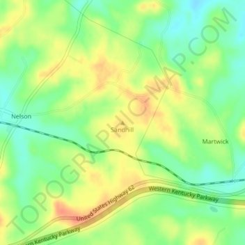
Name: Sandhill topographic map, elevation, terrain.

Location: Sandhill, Muhlenberg County, Kentucky, 42369, United States (37.32899 -87.03686 37.32909 -87.03676)

Average elevation: 143 m

Minimum elevation: 121 m

Maximum elevation: 164 m

Other topographic maps

Click on a map to view its topography, its elevation and its terrain.

Drakesboro

United States > Kentucky > Muhlenberg County

Average elevation: 131 m

Greenville

United States > Kentucky > Muhlenberg County

Average elevation: 149 m

Gear up for your next adventure:

🥾Durable Hiking Shoes - Long-lasting shoes for frequent hiking
🧤Thermal Hiking Gloves - Grip-enhanced gloves for cold-weather altitude trekking
🔦LED Headtorch - Bright and durable light for night activities
⛺Camping Groundsheet - Protect your tent from moisture and dirt
🧢Sun Protection Cap - Breathable cap to protect from sun exposure

As an Amazon Associate, this site earns from qualifying purchases at no extra cost to you.