
Potes topographic map
Interactive map
Click on the map to display elevation.
About this map
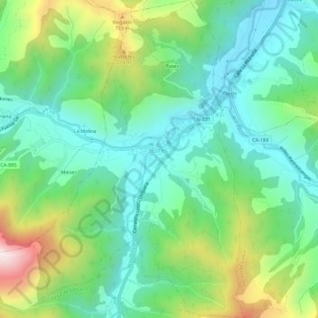
Name: Potes topographic map, elevation, terrain.
Location: Potes, Liébana, Cantabrië, 39570, Spanje (43.13238 -4.64489 43.17275 -4.60865)
Average elevation: 490 m
Minimum elevation: 253 m
Maximum elevation: 1,047 m
Other topographic maps
Click on a map to view its topography, its elevation and its terrain.