Geolocate

Faßmannsreuth topographic map

Click on the map to display elevation.

About this map

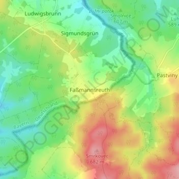
Name: Faßmannsreuth topographic map, elevation, terrain.

Location: Faßmannsreuth, Rehau, Landkreis Hof, Bayern, Deutschland (50.25177 12.10446 50.29177 12.14446)

Average elevation: 615 m

Minimum elevation: 565 m

Maximum elevation: 691 m

Gear up for your next adventure:

🧢Sun Hat - Wide-brim hat for sun protection
🛶Waterproof Dry Bags - Keep electronics and clothes dry during river crossings
🥾Waterproof Trail Shoes - Shoes designed to handle wet terrain
🥾Trail Running Shoes - Lightweight and durable shoes for trail running
🧥Waterproof Pants - Keep dry during rainy hiking conditions

As an Amazon Associate, this site earns from qualifying purchases at no extra cost to you.