Geolocate

Torralba topographic map

Click on the map to display elevation.

About this map

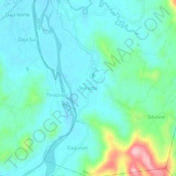
Name: Torralba topographic map, elevation, terrain.

Location: Torralba, Banga, Aklan, Western Visayas, Philippines (11.53479 122.29689 11.57479 122.33689)

Average elevation: 62 m

Minimum elevation: 20 m

Maximum elevation: 228 m

Gear up for your next adventure:

🎒Hiking Backpack - Lightweight and ergonomic backpacks for day hikes or multi-day treks
👖Convertible Hiking Pants - Zip-off legs to adapt to changing weather conditions
🥾Waterproof Hiking Boots - Essential footwear for rugged terrain and wet Canadian trails
🧭Orienteering Kit - Tools for map reading and navigation in the wild
Camping Tent - Weather-resistant tents suitable for 2 to 6 people

As an Amazon Associate, this site earns from qualifying purchases at no extra cost to you.