Geolocate

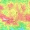
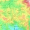
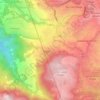
Brookside topographic map

Click on the map to display elevation.

About this map

Name: Brookside topographic map, elevation, terrain.

Location: Brookside, District 19, Central Business District, Baguio, Cordillera Administrative Region, 2600, Philippines (16.41955 120.59973 16.42246 120.60575)

Average elevation: 1,451 m

Minimum elevation: 1,356 m

Maximum elevation: 1,608 m

Other topographic maps

Click on a map to view its topography, its elevation and its terrain.

Pacdal Circle Park

Philippines > Baguio

Average elevation: 1,482 m

Burnham Park

Philippines > Baguio

Average elevation: 1,445 m

Upper Magsaysay

Philippines > Baguio > Upper Magsaysay

Average elevation: 1,456 m

Ferdinand

Philippines > Baguio

Average elevation: 1,416 m

Palma - Urbano

Philippines > Baguio

Average elevation: 1,432 m

Salud Mitra

Philippines > Baguio

Average elevation: 1,444 m

Harrison-Claudio-Carantes

Philippines > Baguio

Average elevation: 1,446 m

Panagbenga Park

Philippines > Baguio

Average elevation: 1,442 m

Dominican Hill

Philippines > Baguio

Average elevation: 1,434 m

Poblacion

Philippines > Baguio

Average elevation: 1,292 m

Bayan Park

Philippines > Baguio

Average elevation: 1,470 m

Pine Trees of the World Park

Philippines > Baguio

Average elevation: 1,436 m

Lagoon Tunnel

Philippines > Baguio

Average elevation: 1,421 m

Mines View Park

Philippines > Baguio

Average elevation: 1,439 m

Tam-Awan Village

Philippines > Baguio

Average elevation: 1,430 m

Gear up for your next adventure:

🧤Thermal Hiking Gloves - Grip-enhanced gloves for cold-weather altitude trekking
🚲Heavy Duty Bike Lock - Secure your bike at the trailhead or during stops
💧Hydration Pack - Hands-free hydration system for long hikes
🧥Packable Rain Jacket - Breathable waterproof layer for unpredictable weather
🔦LED Headlamp - Hands-free lighting for early morning starts or late finishes

As an Amazon Associate, this site earns from qualifying purchases at no extra cost to you.