Geolocate

Briceño topographic map

Click on the map to display elevation.

About this map

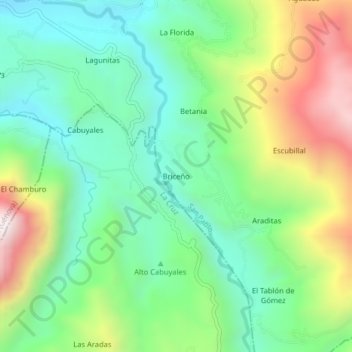
Name: Briceño topographic map, elevation, terrain.

Location: Briceño, San Pablo, Río Mayo, Nariño, RAP Pacífico, Colombia (1.63133 -76.99068 1.67133 -76.95068)

Average elevation: 2,119 m

Minimum elevation: 1,781 m

Maximum elevation: 2,767 m

Gear up for your next adventure:

🧳Compression Sacks - Maximize space in your backpack by shrinking gear
🧥Ultralight Puffy Jacket - Maximum warmth that packs down to the size of an orange
🦟Insect Repellent - Keep mosquitoes and black flies away in wooded areas
❄️Traction Ice Cleats - Slip-on spikes for icy trails and winter hiking
📷Outdoor Action Camera - Capture high-elevation views and rugged adventures

As an Amazon Associate, this site earns from qualifying purchases at no extra cost to you.