
Thank you for supporting this site ❤️
Make a donation
Make a donation
Gear up for your next adventure:
As an Amazon Associate, this site earns from qualifying purchases at no extra cost to you.
Estella-Lizarra topographic map
Click on the map to display elevation.
Thank you for supporting this site ❤️
Make a donation
Make a donation
Gear up for your next adventure:
As an Amazon Associate, this site earns from qualifying purchases at no extra cost to you.
About this map
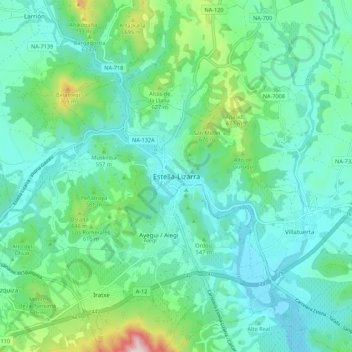
Name: Estella-Lizarra topographic map, elevation, terrain.
Location: Estella-Lizarra, Navarre, 31200, Espagne (42.63209 -2.07148 42.71209 -1.99148)
Average elevation: 514 m
Minimum elevation: 398 m
Maximum elevation: 961 m
Thank you for supporting this site ❤️
Make a donation
Make a donation
Gear up for your next adventure:
As an Amazon Associate, this site earns from qualifying purchases at no extra cost to you.