
Thank you for supporting this site ❤️
Make a donation
Make a donation
Gear up for your next adventure:
As an Amazon Associate, this site earns from qualifying purchases at no extra cost to you.
Cumbilla topographic map
Click on the map to display elevation.
Thank you for supporting this site ❤️
Make a donation
Make a donation
Gear up for your next adventure:
As an Amazon Associate, this site earns from qualifying purchases at no extra cost to you.
About this map
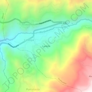
Name: Cumbilla topographic map, elevation, terrain.
Location: Cumbilla, La Moya, Guasuntos, Alausí, Chimborazo, Ecuador (-2.26201 -78.82444 -2.22201 -78.78444)
Average elevation: 2,712 m
Minimum elevation: 2,242 m
Maximum elevation: 3,465 m
Thank you for supporting this site ❤️
Make a donation
Make a donation
Gear up for your next adventure:
As an Amazon Associate, this site earns from qualifying purchases at no extra cost to you.