
Thank you for supporting this site ❤️
Make a donation
Make a donation
Gear up for your next adventure:
As an Amazon Associate, this site earns from qualifying purchases at no extra cost to you.
Aiza topographic map
Click on the map to display elevation.
Thank you for supporting this site ❤️
Make a donation
Make a donation
Gear up for your next adventure:
As an Amazon Associate, this site earns from qualifying purchases at no extra cost to you.
About this map
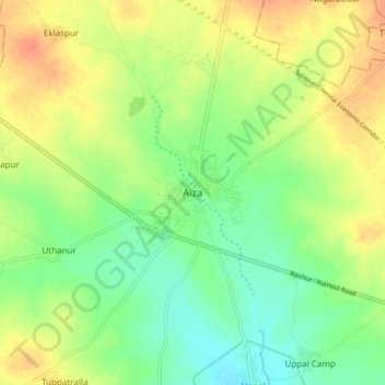
Name: Aiza topographic map, elevation, terrain.
Location: Aiza, Aiza mandal, Jogulamba Gadwal, Telangana, 509127, India (15.97550 77.62657 16.05550 77.70657)
Average elevation: 336 m
Minimum elevation: 316 m
Maximum elevation: 359 m
Thank you for supporting this site ❤️
Make a donation
Make a donation
Gear up for your next adventure:
As an Amazon Associate, this site earns from qualifying purchases at no extra cost to you.