Geolocate

Nazareno topographic map

Click on the map to display elevation.

About this map

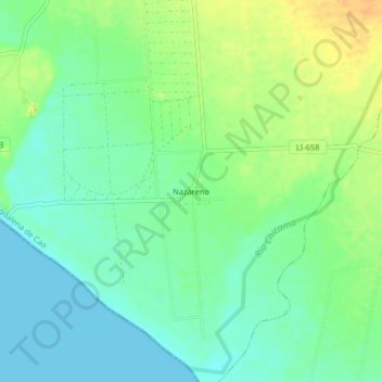
Name: Nazareno topographic map, elevation, terrain.

Location: Nazareno, Magdalena de Cao, Ascope, La Libertad, Perú (-7.94334 -79.30667 -7.90334 -79.26667)

Average elevation: 13 m

Minimum elevation: -1 m

Maximum elevation: 31 m

Gear up for your next adventure:

🩹Compact First Aid Kit - Pre-packed essentials for common trail injuries
🧢Outdoor Cap - Protective cap for sun and rain during hikes
🥾Lightweight Hiking Shoes - Comfortable shoes for day hikes
🛁Quick-Dry Microfiber Towel - Space-saving towel that dries rapidly on the move
🥾Trail Running Boots - Durable shoes designed for trail running

As an Amazon Associate, this site earns from qualifying purchases at no extra cost to you.