Geolocate

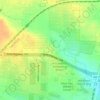
Justin topographic map

Click on the map to display elevation.

About this map

Name: Justin topographic map, elevation, terrain.

Location: Justin, Denton County, Texas, United States (33.06812 -97.31433 33.10098 -97.28202)

Average elevation: 198 m

Minimum elevation: 179 m

Maximum elevation: 221 m

Other topographic maps

Click on a map to view its topography, its elevation and its terrain.

Union Hill

United States > Texas > Denton County

Average elevation: 200 m

Fort Worth

United States > Texas > Denton County

Average elevation: 213 m

Hills of Roanoke

United States > Texas > Denton County > Roanoke

Average elevation: 180 m

Mustang

United States > Texas > Denton County

Average elevation: 182 m

Parvin

United States > Texas > Denton County > Prosper

Average elevation: 180 m

Stony

United States > Texas > Denton County

Average elevation: 240 m

Gear up for your next adventure:

🏕️Camping Hammock - Integrated protection for sleeping between trees
🚲MTB Frame Bag - Carry tools and maps directly on your bicycle frame
🥾Trail Running Boots - Durable shoes designed for trail running
💡LED Camping Lantern - Illuminate your campsite with long-lasting lanterns
🧢Hiking Hat - Sun-protective and breathable hats for long treks

As an Amazon Associate, this site earns from qualifying purchases at no extra cost to you.