Geolocate

Srikona topographic map

Click on the map to display elevation.

About this map

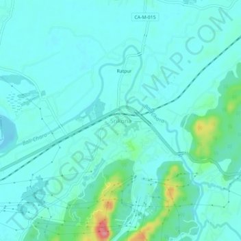
Name: Srikona topographic map, elevation, terrain.

Location: Srikona, Silchar, Cachar, Assam, 788026, India (24.81882 92.69746 24.85882 92.73746)

Average elevation: 26 m

Minimum elevation: 11 m

Maximum elevation: 105 m

Gear up for your next adventure:

🧢Sun Protection Cap - Breathable cap to protect from sun exposure
🧭Orienteering Kit - Tools for map reading and navigation in the wild
🕶️Polarized Sunglasses - Reduces glare from snow and water at high elevations
🧢Outdoor Cap - Protective cap for sun and rain during hikes
👟Leg Gaiters - Keep debris, mud, and snow out of your boots

As an Amazon Associate, this site earns from qualifying purchases at no extra cost to you.