
Thank you for supporting this site ❤️
Make a donation
Make a donation
Gear up for your next adventure:
As an Amazon Associate, this site earns from qualifying purchases at no extra cost to you.
Lammermoor topographic map
Click on the map to display elevation.
Thank you for supporting this site ❤️
Make a donation
Make a donation
Gear up for your next adventure:
As an Amazon Associate, this site earns from qualifying purchases at no extra cost to you.
About this map
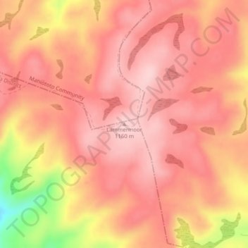
Name: Lammermoor topographic map, elevation, terrain.
Location: Lammermoor, Clutha District, Otago, New Zealand (-45.72044 169.73726 -45.72034 169.73736)
Average elevation: 1,106 m
Minimum elevation: 954 m
Maximum elevation: 1,159 m
Thank you for supporting this site ❤️
Make a donation
Make a donation
Gear up for your next adventure:
As an Amazon Associate, this site earns from qualifying purchases at no extra cost to you.