Geolocate

Ozark topographic map

Click on the map to display elevation.

About this map

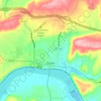
Name: Ozark topographic map, elevation, terrain.

Location: Ozark, Franklin County, Arkansas, 72949, United States (35.46582 -93.87469 35.52686 -93.80167)

Average elevation: 167 m

Minimum elevation: 107 m

Maximum elevation: 260 m

Other topographic maps

Click on a map to view its topography, its elevation and its terrain.

Gear up for your next adventure:

💧Hydration Pack - Hands-free hydration system for long hikes
🧭GPS Tracker - Track your location in remote areas safely
🧶550 Survival Paracord - Versatile utility cord for emergency repairs and rigging
👖Convertible Hiking Pants - Zip-off legs to adapt to changing weather conditions
🧴Bear Spray Holster - Quick-access carry for essential Canadian wilderness safety

As an Amazon Associate, this site earns from qualifying purchases at no extra cost to you.