Geolocate

Franklin topographic map

Click on the map to display elevation.

About this map

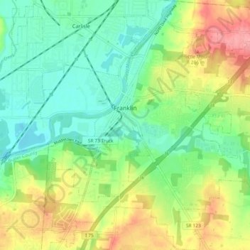
Name: Franklin topographic map, elevation, terrain.

Location: Franklin, Warren County, Ohio, United States (39.51898 -84.33512 39.58906 -84.25371)

Average elevation: 232 m

Minimum elevation: 194 m

Maximum elevation: 296 m

Gear up for your next adventure:

🔦LED Headlamp - Hands-free lighting for early morning starts or late finishes
🎒Hiking Backpack - Lightweight and ergonomic backpacks for day hikes or multi-day treks
🥾Lightweight Hiking Boots - Boots for comfort and mobility on long hikes
🩹Moleskin Blister Pads - Direct protection for painful foot pressure points
🍽️Titanium Camping Spork - Ultralight and indestructible eating utensil

As an Amazon Associate, this site earns from qualifying purchases at no extra cost to you.