Geolocate

Anislagan topographic map

Click on the map to display elevation.

About this map

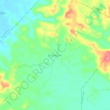
Name: Anislagan topographic map, elevation, terrain.

Location: Anislagan, San Luis, Agusan del Sur, Caraga, 8511, Philippines (8.57972 125.77643 8.61972 125.81643)

Average elevation: 51 m

Minimum elevation: 23 m

Maximum elevation: 104 m

Gear up for your next adventure:

🧥Fleece Jacket - Warm and lightweight jacket for layering
🧤Rechargeable Heated Gloves - Extreme warmth for Canadian winter expeditions
🦌Outdoor Trail Camera - Monitor wildlife activity near your favorite spots
🧊Insulated Water Bottle - Keeps drinks cold in summer and prevents freezing in winter
🥾Trail Hiking Socks - Comfortable socks to prevent blisters and fatigue

As an Amazon Associate, this site earns from qualifying purchases at no extra cost to you.