
Kanata North topographic map
Click on the map to display elevation.
About this map
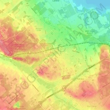
Name: Kanata North topographic map, elevation, terrain.
Location: Kanata North, Ottawa, Eastern Ontario, Ontario, Canada (45.28933 -75.95724 45.37181 -75.88586)
Average elevation: 95 m
Minimum elevation: 53 m
Maximum elevation: 130 m
Ontario trails, hiking, mountain biking, running and outdoor activities
Other topographic maps
Click on a map to view its topography, its elevation and its terrain.