
Thank you for supporting this site ❤️
Make a donation
Make a donation
Gear up for your next adventure:
As an Amazon Associate, this site earns from qualifying purchases at no extra cost to you.
Seebach topographic map
Click on the map to display elevation.
Thank you for supporting this site ❤️
Make a donation
Make a donation
Gear up for your next adventure:
As an Amazon Associate, this site earns from qualifying purchases at no extra cost to you.
About this map
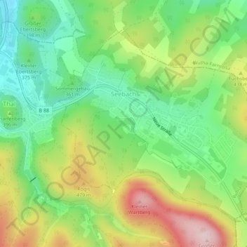
Name: Seebach topographic map, elevation, terrain.
Location: Seebach, Ruhla, Wartburgkreis, Thüringen, 99846, Deutschland (50.90303 10.40541 50.92379 10.44331)
Average elevation: 395 m
Minimum elevation: 278 m
Maximum elevation: 571 m
Thank you for supporting this site ❤️
Make a donation
Make a donation
Gear up for your next adventure:
As an Amazon Associate, this site earns from qualifying purchases at no extra cost to you.