
Thank you for supporting this site ❤️
Make a donation
Make a donation
Gear up for your next adventure:
As an Amazon Associate, this site earns from qualifying purchases at no extra cost to you.
Úrcal topographic map
Click on the map to display elevation.
Thank you for supporting this site ❤️
Make a donation
Make a donation
Gear up for your next adventure:
As an Amazon Associate, this site earns from qualifying purchases at no extra cost to you.
About this map
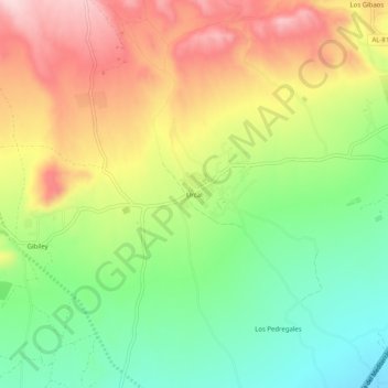
Name: Úrcal topographic map, elevation, terrain.
Location: Úrcal, Huércal-Overa, Almeria, Andalusia, Spain (37.44642 -1.94130 37.48642 -1.90130)
Average elevation: 487 m
Minimum elevation: 370 m
Maximum elevation: 623 m
Thank you for supporting this site ❤️
Make a donation
Make a donation
Gear up for your next adventure:
As an Amazon Associate, this site earns from qualifying purchases at no extra cost to you.