Geolocate

Rokan topographic map

Click on the map to display elevation.

About this map

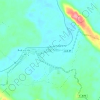
Name: Rokan topographic map, elevation, terrain.

Location: Rokan, Rokan IV Koto, Rokan Hulu, Riau, Sumatra, Indonesia (0.54774 100.39688 0.58774 100.43688)

Average elevation: 93 m

Minimum elevation: 70 m

Maximum elevation: 184 m

Gear up for your next adventure:

👟Trail Running Shoes - Agile footwear for fast-paced topographic exploration
🥾Hiking Shoes - Durable and comfortable shoes for trail hiking
🧥Insulated Jacket - Keep warm in cold outdoor conditions
🧥Waterproof Hiking Jacket - Protect yourself from rain and wind while hiking
🧤Thermal Hiking Gloves - Grip-enhanced gloves for cold-weather altitude trekking

As an Amazon Associate, this site earns from qualifying purchases at no extra cost to you.