
Williamson County topographic map
Click on the map to display elevation.
About this map
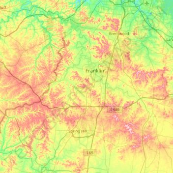
Name: Williamson County topographic map, elevation, terrain.
Location: Williamson County, Tennessee, United States (35.70631 -87.21508 36.05272 -86.59952)
Average elevation: 227 m
Minimum elevation: 128 m
Maximum elevation: 373 m
Other topographic maps
Click on a map to view its topography, its elevation and its terrain.