
Thank you for supporting this site ❤️
Make a donation
Make a donation
Gear up for your next adventure:
As an Amazon Associate, this site earns from qualifying purchases at no extra cost to you.
Tokoiti topographic map
Click on the map to display elevation.
Thank you for supporting this site ❤️
Make a donation
Make a donation
Gear up for your next adventure:
As an Amazon Associate, this site earns from qualifying purchases at no extra cost to you.
About this map
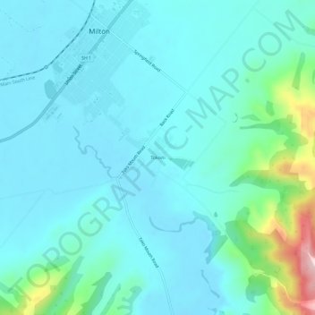
Name: Tokoiti topographic map, elevation, terrain.
Location: Tokoiti, Milton, Clutha District, Otago, 9220, New Zealand (-46.15282 169.95318 -46.11282 169.99318)
Average elevation: 50 m
Minimum elevation: 4 m
Maximum elevation: 299 m
Thank you for supporting this site ❤️
Make a donation
Make a donation
Gear up for your next adventure:
As an Amazon Associate, this site earns from qualifying purchases at no extra cost to you.