
Thank you for supporting this site ❤️
Make a donation
Make a donation
Gear up for your next adventure:
As an Amazon Associate, this site earns from qualifying purchases at no extra cost to you.
Toli topographic map
Click on the map to display elevation.
Thank you for supporting this site ❤️
Make a donation
Make a donation
Gear up for your next adventure:
As an Amazon Associate, this site earns from qualifying purchases at no extra cost to you.
About this map
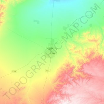
Name: Toli topographic map, elevation, terrain.
Location: Toli, Tuoli, Toli County, Tacheng Prefecture, Xinjiang, China (45.77628 83.44271 46.09628 83.76271)
Average elevation: 1,225 m
Minimum elevation: 751 m
Maximum elevation: 2,002 m
Thank you for supporting this site ❤️
Make a donation
Make a donation
Gear up for your next adventure:
As an Amazon Associate, this site earns from qualifying purchases at no extra cost to you.