Geolocate

Halifax topographic map

Click on the map to display elevation.

About this map

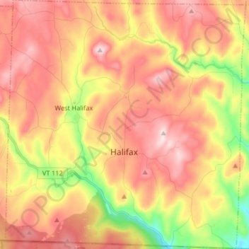
Name: Halifax topographic map, elevation, terrain.

Location: Halifax, Windham County, Vermont, 05358, United States (42.73325 -72.80697 42.82914 -72.68063)

Average elevation: 443 m

Minimum elevation: 224 m

Maximum elevation: 607 m

Gear up for your next adventure:

🥾Lightweight Hiking Boots - Boots for comfort and mobility on long hikes
🥾Hiking Shorts - Breathable shorts suitable for summer hikes
🥾Mountain Hiking Boots - High-traction boots for rocky terrain
💧Filtered Water Bottle - Safe drinking water on the go
🥾Mountaineering Boots - Supportive boots for climbing and high-altitude hiking

As an Amazon Associate, this site earns from qualifying purchases at no extra cost to you.