Geolocate

Bonbon topographic map

Click on the map to display elevation.

About this map

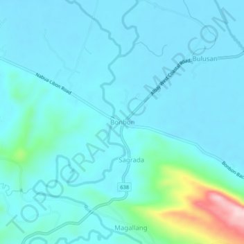
Name: Bonbon topographic map, elevation, terrain.

Location: Bonbon, Albay, Bicol Region, Philippines (13.25742 123.37538 13.29742 123.41538)

Average elevation: 41 m

Minimum elevation: 8 m

Maximum elevation: 264 m

Gear up for your next adventure:

🥽Outdoor Goggles - Protective eyewear for outdoor activities
🧥Insulated Jacket - Keep warm in cold outdoor conditions
🛏️Camping Sleeping Mat - Comfortable mats for sleeping outdoors
🌡️Emergency Mylar Blankets - Compact thermal protection for unexpected nights outdoors
🧥Fleece Jacket - Warm and lightweight jacket for layering

As an Amazon Associate, this site earns from qualifying purchases at no extra cost to you.