Geolocate

Roma topographic map

Click on the map to display elevation.

About this map

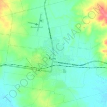
Name: Roma topographic map, elevation, terrain.

Location: Roma, Maranoa Regional, Queensland, 4455, Australia (-26.60740 148.74751 -26.52740 148.82751)

Average elevation: 311 m

Minimum elevation: 291 m

Maximum elevation: 362 m

Gear up for your next adventure:

🧥Waterproof Jacket - Lightweight rain jackets for hiking and outdoor activities
🧥Thermal Layer - Insulating layer for cold outdoor conditions
🧥Waterproof Pants - Keep dry during rainy hiking conditions
💡LED Headlamp - Hands-free illumination for night hiking and camping
🪑Insulated Seat Pad - Protect your seat from cold rocks and wet logs

As an Amazon Associate, this site earns from qualifying purchases at no extra cost to you.