
Thank you for supporting this site ❤️
Make a donation
Make a donation
Gear up for your next adventure:
As an Amazon Associate, this site earns from qualifying purchases at no extra cost to you.
GRADAS topographic map
Click on the map to display elevation.
Thank you for supporting this site ❤️
Make a donation
Make a donation
Gear up for your next adventure:
As an Amazon Associate, this site earns from qualifying purchases at no extra cost to you.
About this map
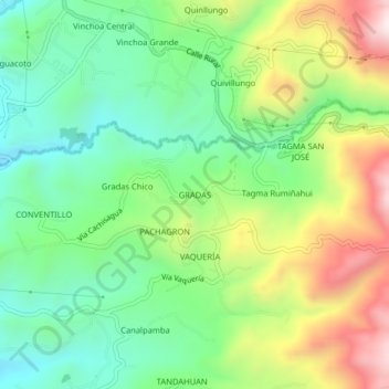
Name: GRADAS topographic map, elevation, terrain.
Location: GRADAS, San Simón, Guaranda, Bolívar, 020150, Ecuador (-1.64017 -78.99824 -1.60017 -78.95824)
Average elevation: 2,799 m
Minimum elevation: 2,542 m
Maximum elevation: 3,238 m
Thank you for supporting this site ❤️
Make a donation
Make a donation
Gear up for your next adventure:
As an Amazon Associate, this site earns from qualifying purchases at no extra cost to you.