Geolocate

Spanish Springs topographic map

Click on the map to display elevation.

About this map
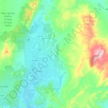
Name: Spanish Springs topographic map, elevation, terrain.

Location: Spanish Springs, Washoe County, Nevada, 89441, United States of America (39.56287 -119.77173 39.73090 -119.58061)

Average elevation: 1,564 m

Minimum elevation: 1,346 m

Maximum elevation: 2,251 m

Other topographic maps

Click on a map to view its topography, its elevation and its terrain.
Gear up for your next adventure:

🥾Trekking Poles - Adjustable trekking poles to reduce knee stress and improve stability
🚲Bike Repair Kit - Essential tools for on-trail mechanical issues
⛺Bushcraft Tarp - Versatile emergency shelter or gear protection
🦟Insect Repellent - Keep mosquitoes and black flies away in wooded areas
🧊Portable Cooler - Keep food and drinks cold during outdoor adventures

As an Amazon Associate, this site earns from qualifying purchases at no extra cost to you.