Geolocate

28 de Julio topographic map

Click on the map to display elevation.

About this map

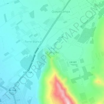
Name: 28 de Julio topographic map, elevation, terrain.

Location: 28 de Julio, Chancay, Huaral, Lima, Perú (-11.56172 -77.27163 -11.52172 -77.23163)

Average elevation: 120 m

Minimum elevation: 46 m

Maximum elevation: 413 m

Other topographic maps

Click on a map to view its topography, its elevation and its terrain.

Humedal Santa Rosa

Perú > Lima > Chancay

Average elevation: 20 m

Playa Puerto Chancay

Perú > Lima > Chancay

Average elevation: 20 m

Gear up for your next adventure:

🎒Backpack Rain Cover - External shield to keep your entire pack dry
🏃Hydration Running Vest - Carry water and maps close to your body for speed
🥾Durable Hiking Shoes - Long-lasting shoes for frequent hiking
🧼Biodegradable Camp Soap - Environmentally friendly cleaning for gear and body
🕶️Polarized Sunglasses - Reduces glare from snow and water at high elevations

As an Amazon Associate, this site earns from qualifying purchases at no extra cost to you.