Geolocate

Viggiano topographic map

Click on the map to display elevation.

About this map

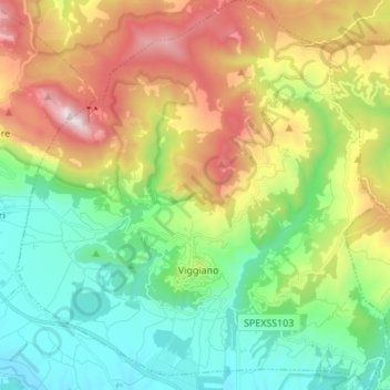
Name: Viggiano topographic map, elevation, terrain.

Location: Viggiano, Potenza, Basilicata, Italy (40.30810 15.83865 40.41213 15.96824)

Average elevation: 966 m

Minimum elevation: 549 m

Maximum elevation: 1,718 m

Other topographic maps

Click on a map to view its topography, its elevation and its terrain.

Agri

Italy > Basilicata > Potenza > San Martino d'Agri

Average elevation: 491 m

Gear up for your next adventure:

🔥Emergency Fire Starter - Reliable ignition source for all weather conditions
🔭Compact Binoculars - Lightweight optics for scouting trails and wildlife
🥾Hiking Boots - Sturdy boots providing ankle support and traction on rugged trails
🧴Insect Repellent - Protect yourself from bugs during outdoor adventures
👟Sport Hiking Sandals - Breathable footwear for water crossings and camp rest

As an Amazon Associate, this site earns from qualifying purchases at no extra cost to you.