Geolocate

Guaranda topographic map

Click on the map to display elevation.

About this map

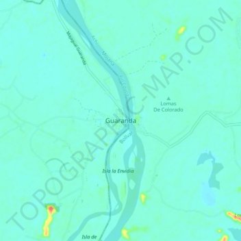
Name: Guaranda topographic map, elevation, terrain.

Location: Guaranda, La Mojana, Sucre, RAP Caribe, Colombia (8.42750 -74.57580 8.50750 -74.49580)

Average elevation: 24 m

Minimum elevation: 14 m

Maximum elevation: 91 m

Gear up for your next adventure:

💧Hydration Pack - Hands-free hydration system for long hikes
🧴First Aid Kit - Essential first aid supplies for outdoor emergencies
🥘Camping Cookware Set - Compact nesting pots and pans for trail cooking
🥾Hiking Boots - Sturdy boots providing ankle support and traction on rugged trails
🥽Outdoor Goggles - Protective eyewear for outdoor activities

As an Amazon Associate, this site earns from qualifying purchases at no extra cost to you.