Geolocate

Modautal topographic map

Click on the map to display elevation.

About this map
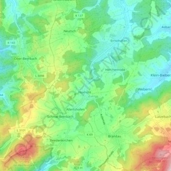
Name: Modautal topographic map, elevation, terrain.

Location: Modautal, Landkreis Darmstadt-Dieburg, Hesse, 64397, Germany (49.72222 8.69977 49.78713 8.79057)

Average elevation: 333 m

Minimum elevation: 195 m

Maximum elevation: 598 m

Gear up for your next adventure:

🧥Packable Rain Jacket - Breathable waterproof layer for unpredictable weather
🧊Insulated Water Bottle - Keeps drinks cold in summer and prevents freezing in winter
🧢Hiking Hat - Sun-protective and breathable hats for long treks
💧Filtered Water Bottle - Safe drinking water on the go
🧥Waterproof Hiking Jacket - Protect yourself from rain and wind while hiking

As an Amazon Associate, this site earns from qualifying purchases at no extra cost to you.