
Thank you for supporting this site ❤️
Make a donation
Make a donation
Gear up for your next adventure:
As an Amazon Associate, this site earns from qualifying purchases at no extra cost to you.
Täschhorn topographic map
Click on the map to display elevation.
Thank you for supporting this site ❤️
Make a donation
Make a donation
Gear up for your next adventure:
As an Amazon Associate, this site earns from qualifying purchases at no extra cost to you.
About this map
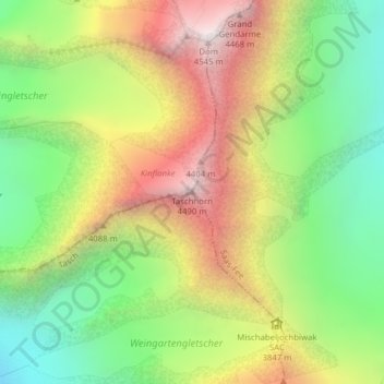
Name: Täschhorn topographic map, elevation, terrain.
Location: Täschhorn, Täsch, Visp, Vallese, 3929, Svizzera (46.08338 7.85714 46.08348 7.85724)
Average elevation: 3,723 m
Minimum elevation: 3,058 m
Maximum elevation: 4,538 m
Thank you for supporting this site ❤️
Make a donation
Make a donation
Gear up for your next adventure:
As an Amazon Associate, this site earns from qualifying purchases at no extra cost to you.