
Gavoi topographic map
Interactive map
Click on the map to display elevation.
About this map
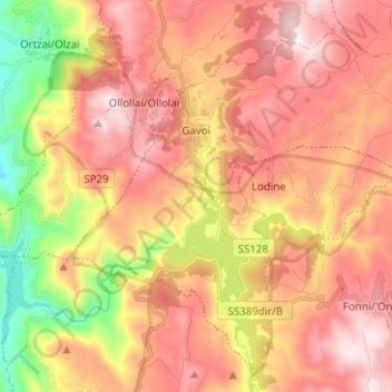
Name: Gavoi topographic map, elevation, terrain.
Location: Gavoi, Nuoro, Sardinië, 08020, Italië (40.10310 9.15512 40.18812 9.28013)
Average elevation: 765 m
Minimum elevation: 290 m
Maximum elevation: 1,111 m
Other topographic maps
Click on a map to view its topography, its elevation and its terrain.