
Thank you for supporting this site ❤️
Make a donation
Make a donation
Gear up for your next adventure:
As an Amazon Associate, this site earns from qualifying purchases at no extra cost to you.
الضارب topographic map
Click on the map to display elevation.
Thank you for supporting this site ❤️
Make a donation
Make a donation
Gear up for your next adventure:
As an Amazon Associate, this site earns from qualifying purchases at no extra cost to you.
About this map
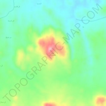
Name: الضارب topographic map, elevation, terrain.
Location: الضارب, Sarat Abidah, 'Asir Province, Saudi Arabia (18.09830 43.26385 18.09840 43.26395)
Average elevation: 2,242 m
Minimum elevation: 2,184 m
Maximum elevation: 2,352 m
Thank you for supporting this site ❤️
Make a donation
Make a donation
Gear up for your next adventure:
As an Amazon Associate, this site earns from qualifying purchases at no extra cost to you.