Geolocate

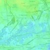
Molo topographic map

Click on the map to display elevation.

About this map

Name: Molo topographic map, elevation, terrain.

Location: Molo, Navais, Iloilo City, Western Visayas, 5000, Philippines (10.67914 122.52655 10.70208 122.55526)

Average elevation: 3 m

Minimum elevation: -4 m

Maximum elevation: 7 m

Other topographic maps

Click on a map to view its topography, its elevation and its terrain.
First Home

Philippines > Iloilo City > Navais

Average elevation: 5 m

Gear up for your next adventure:

🗺️Topographic Maps - Detailed maps to explore trails, mountains, and wilderness areas
🚲Handlebar Phone Mount - View topographic-map.com live while cycling
🪜Heavy Duty Carabiners - Multi-use clips for securing gear to your backpack
🛁Quick-Dry Microfiber Towel - Space-saving towel that dries rapidly on the move
🥾Mountaineering Boots - Supportive boots for climbing and high-altitude hiking

As an Amazon Associate, this site earns from qualifying purchases at no extra cost to you.