Geolocate

Cope Lake topographic map

Click on the map to display elevation.

About this map

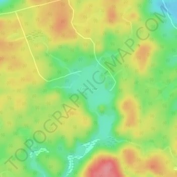
Name: Cope Lake topographic map, elevation, terrain.

Location: Cope Lake, Highlands East, Haliburton County, Central Ontario, Ontario, Canada (45.05031 -78.16394 45.05744 -78.15473)

Average elevation: 453 m

Minimum elevation: 407 m

Maximum elevation: 500 m

Haliburton County trails, hiking, mountain biking, running and outdoor activities

Other topographic maps

Click on a map to view its topography, its elevation and its terrain.

Gooderham

Canada > Ontario > Haliburton County > Highlands East

Average elevation: 349 m

Wilberforce

Canada > Ontario > Haliburton County > Highlands East

Average elevation: 407 m

Monck Lake

Canada > Ontario > Haliburton County > Highlands East

Average elevation: 417 m

Tory Hill

Canada > Ontario > Haliburton County > Highlands East

Average elevation: 401 m

Esson Lake

Canada > Ontario > Haliburton County > Highlands East

Average elevation: 421 m

Cardiff

Canada > Ontario > Haliburton County > Highlands East

Average elevation: 366 m

Gear up for your next adventure:

🥾Trekking Boots - Durable boots for long-distance trekking
🧣Merino Neck Gaiter - Protects against wind, sun, and cold at high altitudes
🧦Merino Wool Socks - Moisture-wicking comfort for long-distance hiking
Camping Tent - Weather-resistant tents suitable for 2 to 6 people
🔋Solar Power Bank - Keep your GPS and devices charged during long outdoor trips

As an Amazon Associate, this site earns from qualifying purchases at no extra cost to you.