
Kucherla topographic map
Interactive map
Click on the map to display elevation.
About this map
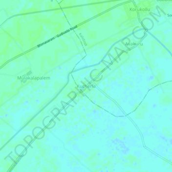
Name: Kucherla topographic map, elevation, terrain.
Location: Kucherla, Kalidindi, Eluru, Andhra Pradesh, 521343, Inde (16.44585 81.21193 16.48585 81.25193)
Average elevation: 3 m
Minimum elevation: -1 m
Maximum elevation: 7 m