Geolocate

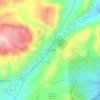
La Rondinara topographic map

Click on the map to display elevation.

About this map

Name: La Rondinara topographic map, elevation, terrain.

Location: La Rondinara, Suartone, Bonifacio / Bunifaziu, Sartène, Corse-du-Sud, Corse, France métropolitaine, 20169, France (41.47212 9.25802 41.47466 9.26298)

Average elevation: 67 m

Minimum elevation: -5 m

Maximum elevation: 186 m

Other topographic maps

Click on a map to view its topography, its elevation and its terrain.
Chiova-d'Asino

France > Corse > Corse-du-Sud > Suartone

Average elevation: 126 m

Gear up for your next adventure:

🧴Sunscreen SPF - Broad-spectrum sunscreen for outdoor activities
🧥Waterproof Hiking Jacket - Protect yourself from rain and wind while hiking
🐕Hiking Dog Pack - Let your canine companion carry their own water and food
🧰Emergency Multi-Tool - Compact multi-tool for outdoor survival
💡LED Camping Lantern - Illuminate your campsite with long-lasting lanterns

As an Amazon Associate, this site earns from qualifying purchases at no extra cost to you.